

Giffre Shuttles
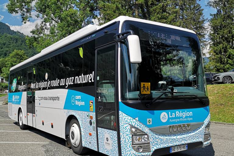
Description
This summer, let yourself be whisked away in complete peace of mind!
Explore the villages, run some errands, head to a hiking trailhead, a recreation center, or the “Au fil du Giffre” trail...
Leave your car behind and take public transportation when traveling in the Giffre Mountains!
Departing from Cluses, Mieussy/Sommand, Châtillon-sur-Cluses, Taninges/Praz de Lys, La Rivière-Enverse, Morillon, Verchaix, Samoëns, and Sixt Fer à Cheval.
Line 1: Mieussy → Cirque du Fer à Cheval (50 seats / 6 bikes)
Lines 2 and Y94: Châtillon-sur-Cluses → Cirque du Fer à Cheval (50 seats / 6 bikes)
Line 4: Loop: Mieussy → Sommand → Praz de Lys → (22 seats / trailer for paragliders)
Line 4: Taninges Loop → Praz de Lys → Sommand → (22 seats / paraglider trailer)
Line 5: Samoëns → Joux Plane (50 seats / 6 bikes)
Line 6: Sixt Fer à Cheval → Lignon (22-passenger capacity)
Line 7: Morillon gondola connecting the town center to the Esserts plateau (Morillon 1100),
Line 8: Samoëns → Plan aux Arches/Les Allamands (19-passenger capacity)
Princing
Free entry for children under 6.
50% discount for holders of a Mobility Inclusion Card or an Illico Mobility Card, and free travel for the companion of cardholders.
-50%
for children ages 6 to 9, valid only for the 1-day pass.
1-DAY PASS = €2
Valid throughout the entire Communauté de Communes network (excluding Cluses)
Unlimited trips on the same day.
Purchase on board the shuttles from the driver.
Departure from or arrival in Cluses / 1-day pass = €6 or €8
If departing from or arriving in Cluses, only the 1-day pass is available.
- €6 to or from the towns of Châtillon-sur-Cluses, Taninges, Mieussy, La Rivière Enverse, Morillon, and Verchaix.
- €8 to or from the towns of Samoëns and Sixt-Fer-à-Cheval.
10-DAY PASS = €10
Valid throughout the entire Communauté de Communes network (excluding Cluses)
Non-transferable pass.
Example: A family of 5 can use the card for 2 days,
whether consecutive or not (5 people × 2 days = 10 days)
Purchase via the OURA app.
Additional information
Spoken languages
Equipements
Pets
Pets not allowed
See also...