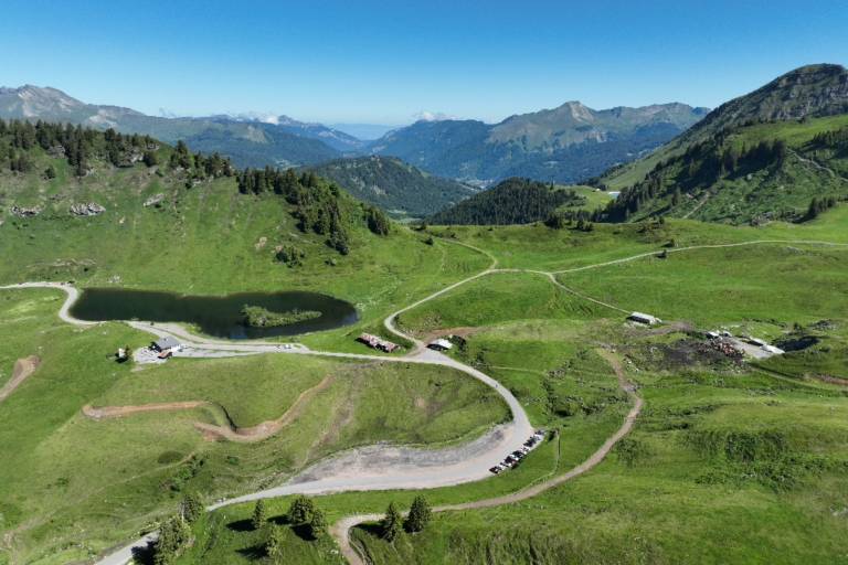
Walking itinerary: rando'bus Descente de Joux Plane

Medium
4h50min
15.7km
-1085m
Walking itinerary: rando'bus Descente de Joux Plane image1Walking itinerary: rando'bus Descente de Joux Plane image2Walking itinerary: rando'bus Descente de Joux Plane image3
1 / 3

Description

Want to walk down the southern slope from the legendary Joux Plane pass?
Use the destination's mobility network to hike for longer, without having to make the round trip.

Marking

Wooden posts and yellow signs, indicating the names of the localities and the remaining journey time.

Map references

IGN TOP 25 - 3530 ET Samoëns map - on sale at the tourist office and in shops. Montagnes du Giffre hiking map - CCMG - on sale at the tourist office.

Amenities

Guided steps

Departure by shuttle from Samoëns - Office de Tourisme
Departure on foot from Samoëns - Col de Joux Plane

1/ From the parking lot, turn left around the lake, passing the chalet, then follow the signs for Les Couttaz.

2/ Continue downhill through the forest, following Croz d'en Haut, then continue towards Lairon.

3/ Then follow signs for La Mouille au Bois, then Montieux, then downhill to La Chaumette.

4/ Follow signs for Le Chaumieu, then La Plaigne and La Rapaz. Go back down to the main road, following signs for Charrières and then Les Hottes Est.

5/ Cross the main road at Pont de la Valentine to reach Lac Bleu de Morillon.

6/ Continue along the Au Fil du Giffre path towards Samoëns Lacs Aux Dames.

7/ From the Base de Loisirs, take the Avenue du Giffre into the center of Samoëns.

8/ Arrival at Samoëns Tourist Office

Address
Parking du Col de Joux Plane, 74340, Samoëns
Opening
From 05/07 to 31/08 daily.

Was this content helpful to you?

Address
Parking du Col de Joux Plane, 74340, Samoëns
Opening
From 05/07 to 31/08 daily.