Hiking Trail: Loëx Plateau

Easy
1h20min
5km
Loop
+210m
-210m
Hiking Trail: Loëx Plateau image1Hiking Trail: Loëx Plateau image2Hiking Trail: Loëx Plateau image3Hiking Trail: Loëx Plateau image4Hiking Trail: Loëx Plateau image5Hiking Trail: Loëx Plateau image6Hiking Trail: Loëx Plateau image7Hiking Trail: Loëx Plateau image8
1 / 8

Description

A family-friendly loop hike through a beautiful, unspoiled natural area, with the Jacquicourt Chapel—a building steeped in local history—as the highlight.

During this easy hike, take your time exploring the summit plateau of Mount Loëx.

Easily accessible from Taninges, the Loëx Plateau (pronounced “Loi”) is a sensitive natural area designated as a Natura 2000 site. Boasting a rich diversity of natural habitats, it serves as a prime habitat for remarkable flora and fauna.

As you follow the trail, you’ll pass through landscapes with varied atmospheres, ranging from coniferous forests to wetlands and pastures.

At the Chalet de Veruy, a beautiful panorama opens up onto the Col de Joux Plane, the Pointe de Chamossière, and La Bourgeoise.

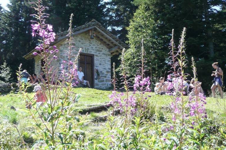
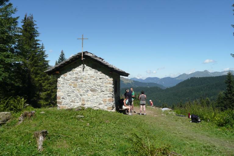
Take the time to admire the entire plateau from the Chapelle de Jacquicourt. Built in 1679, it marks the border between Taninges, Verchaix, and Les Gets. Destroyed that same year due to disputes over the boundaries of the alpine pastures, it was rebuilt exactly as it was between 1986 and 1989, thus putting an end to six centuries of conflict.

Marking

Departmental signage on a beige metal sign with green lettering.

Map references

IGN Map 3430 ET (Samoëns / Haut Giffre)

Amenities

Guided steps

1/ Starting at the "Les Rossignols (Parking)" signpost, head toward "Chapelle de Jacquicourt (Direct)." Continue following the signs for Chapelle de Jacquicourt; you’ll pass through “Le Coutard” and “Pierre à Feu.”
2/ When you reach the signpost marked “Chapelle de Jacquicourt,” continue toward “Les Rossignols (Parking via Veruy).” Continue to follow the signs for “Les Rossignols (Parking),” passing through “Veruy,” “Pré du four,” “Les Têtes,” and “la Plateforme,” to return to your starting point.

Address
Parking les Rossignols, 74440, Taninges

12 km from Taninges. Follow the signs for Les Gets (D307) for 3 km, then at the hamlet of “Vers le Mont,” turn right toward Mont Loëx. At the Mouille Rosse junction, turn right and park at the start of the Têtes trail.

Opening
From 15/05 to 15/11 daily. Check with the Tourist Office in advance to find out the current access requirements. Subject to favorable snow and weather conditions.

Subject to favorable weather, Subject to snow conditions

Was this content helpful to you?

Address
Parking les Rossignols, 74440, Taninges

12 km from Taninges. Follow the signs for Les Gets (D307) for 3 km, then at the hamlet of “Vers le Mont,” turn right toward Mont Loëx. At the Mouille Rosse junction, turn right and park at the start of the Têtes trail.

Opening
From 15/05 to 15/11 daily. Check with the Tourist Office in advance to find out the current access requirements. Subject to favorable snow and weather conditions.

Subject to favorable weather, Subject to snow conditions