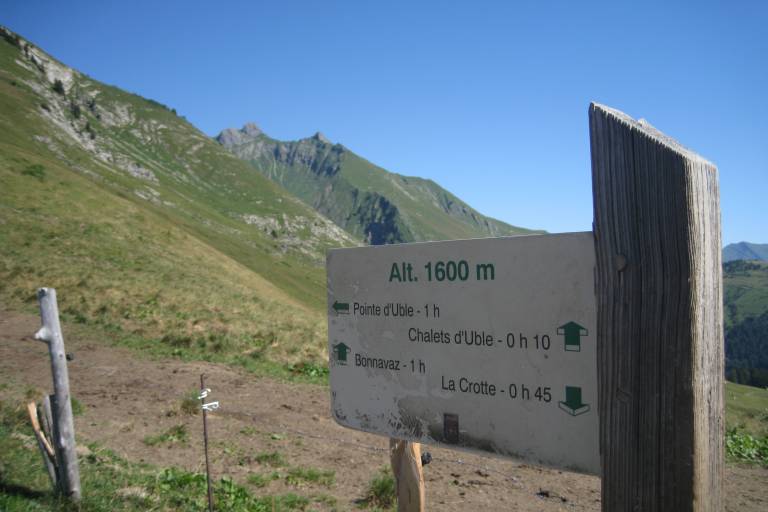
A mid-mountain trail winding through forests and alpine pastures, offering varied views of the region.
A mountain hiking expedition, a far cry from the lively villages and resorts. Around the Pointe d’Uble, people often see bighorn sheep and chamois. The sections of this itinerary across the pastures offer some great views over the surrounding valleys and mountains.
IGN Map 3429 ET (Bonneville / Cluses / Le Faucigny)
From the parking lot, take the trail on the right that climbs toward the Rosset chalets. The trail then winds through the forest along the cliff face, quickly emerging into a meadow, and continues uphill to a plateau in the middle of the alpine pastures.
1/ From there, in about 1 hour, a trail to the left leads toward the ridgeline and then to the summit (1,963 m).
La Crotte Parking Lot. From Taninges, after passing Fry and the intersection with the Col de l’Encrenaz road, turn right onto the small road at the first curve and follow it for 1 km to the small parking lot. The route is also accessible from downtown Praz de Lys or the Col de la Ramaz.
Subject to favorable weather, Subject to snow conditions
La Crotte Parking Lot. From Taninges, after passing Fry and the intersection with the Col de l’Encrenaz road, turn right onto the small road at the first curve and follow it for 1 km to the small parking lot. The route is also accessible from downtown Praz de Lys or the Col de la Ramaz.
Subject to favorable weather, Subject to snow conditions