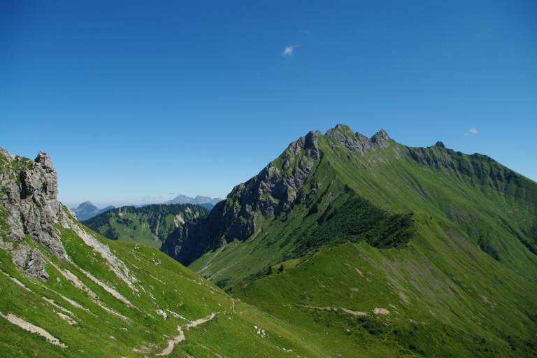
Ecotrail de Praz de Lys Sommand - 50 km

Expert
6h
49.5km
Loop
+3291m
-3297m
Description
A long route over varied terrain, to be completed in 1, 2 or 3 days (overnight stays possible along the way).
The route takes in some of the best views of the Praz de Lys Sommand resort. See you every year on the 3rd Sunday in September for the Ecotrail!
Departure from Sommand plateau:
Cross the parking lot, turn left around Le Refuge restaurant and follow the path into the forest.
Forêt d'Ima :
After 1.5 km in the forest, turn left on the carriage road, then right towards the historic Pertuiset take-off.
Pertuiset:
Turn left, passing 3 chalets, then right behind the last one. Pass the pylon where the ski lift arrives, then continue towards the ridge and Pointe de Perret.
Pointe de Perret :
Follow the path down to the right, then up towards the Pic du Marcelly. Go around it on the north face (do not take the Pas de l'Âne), cross under the peak then turn left to descend towards Le Planey.
Planey:
At the Planey viewpoint, descend to the left, then at the Petit Planey parking lot, turn right towards Pontet/Taninges.
Le Pontet:
Take the paved road towards Praz de Lys.
L'Hôtel:
Turn right and cross the road to reach the center of the resort, along the Chevally double ski lift.
Praz de Lys:
On the road, just past the resort center, turn right onto the wide path leading down to the Praz l'Évêque woods. At the chairlift, turn left up to Les Molliettes.
Les Molliettes :
At the parking lot, turn left in the direction of Brésy, then right twice on the path to Combe de Gron and Lac de Roy.
Lac de Roy :
Go past the chalets, skirt the lake on the right, then cross the torrent and follow the path towards Col de la Ramaz.
Chalets de Véran :
Turn left on the ski slope. At Col de Sommand, descend for 2 km to Chemin de Farquet. Turn left to Parking de Sommand, then left to Lac de Sommand.
Lac de Sommand :
Turn right onto the D308. At Le Matafan restaurant, take the small road rising to the left (hamlet of La Mary), which becomes a footpath after the last chalet. Follow the signs to the Col de Cordon.
Col de Cordon :
Cross the pass and descend to Les Charmettes d'en bas. Turn right on a wide track, then at the last chalet continue on the path and follow the signs to Col de Chavannais.
Col de Chavannais :
At the pass, continue right on the path on the north side of Haute Pointe towards Col de Chavan.
Col de Chavan :
Descend to the Sommand plateau towards Ferme Le Coin. Continue to the Col de la Ramaz road. Turn left onto the D308 and pass under the fence to join a path 10m above the road leading to Chalet Blanc.
Col de Vésinaz :
Follow the signs for Col de Chalune.
Col de Chalune :
Climb to the Pointe de Chalune (round trip) via the path on the left. On the way back, turn left towards the Col de Foron, then right down to the hamlet of Foron.
Foron :
Continue left on the D328, then at Villiaz de Combafou, turn right towards Combafou. Cross a wooden bridge and follow a faint path for 800m. Return to the D328 for 400 m and turn right onto the path towards Chalets d'Uble.
Chalets d'Uble :
At the foot of the pointe d'Uble, cross the small plateau and descend towards La Crotte. Then follow the signs for Praz de Lys.
Beuloz:
Take the road to the right towards the center of Praz de Lys, then turn right after the Tourist Office. Follow the path down into the forest. Turn left on the path leading up to Les Munes.
Les Munes :
Follow the path to the Col de la Ramaz road. Cross the road and follow the path under the Pierre Rouge chairlift to Chemin de Farquet, then to the Plateau de Sommand parking lot.
Pricing
Free access.
Langues
Route GPX track
Parking de Sommand, Sommand, 74440, Mieussy
From 15/05 to 15/11.
Subject to favorable snow and weather conditions.
