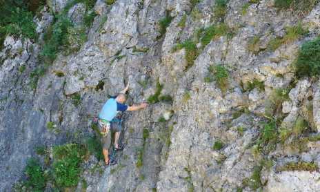
With more than 100 routes, it is one of the most extensive climbing areas in Haute-Savoie. All of these routes are spread across several sectors. The site is less suitable for beginners than the Anthon crag.
Total length: 107 routes + variations
Grade: 5a to 8c
Average elevation of the cliff: 700 m
Approach time: 0 to 10 min
Length of the shortest route: 10 m
Length of the longest route: 130 m
Chapelle Sud sector:
Southwest-facing.
Chapelle Nord sector:
Northeast-facing.
Free access. The Topo Guide is available for purchase at the tourist information offices in Taninges and Mieussy.
Pets allowed
Pets not allowed
Between Taninges and Mieussy, turn right (coming from Taninges) at the hamlet of Les Vagnys toward the Chapelle Saint Grat. Drive up the road almost to the top and park in the lot very close to the chapel. The west face is accessed by taking a trail on the right about 30 meters past the chapel. For the “Baou” and “Chapelle Nord” sectors, take the ascending, vehicle-accessible trail from the parking lot. The “Baou” sector is accessible via a wide trail on the left; continue left uphill to reach the sector. For “Chapelle Nord,” take another trail on the left further up, at a sharp right-hand turn.
Subject to favorable weather
Between Taninges and Mieussy, turn right (coming from Taninges) at the hamlet of Les Vagnys toward the Chapelle Saint Grat. Drive up the road almost to the top and park in the lot very close to the chapel. The west face is accessed by taking a trail on the right about 30 meters past the chapel. For the “Baou” and “Chapelle Nord” sectors, take the ascending, vehicle-accessible trail from the parking lot. The “Baou” sector is accessible via a wide trail on the left; continue left uphill to reach the sector. For “Chapelle Nord,” take another trail on the left further up, at a sharp right-hand turn.
Subject to favorable weather